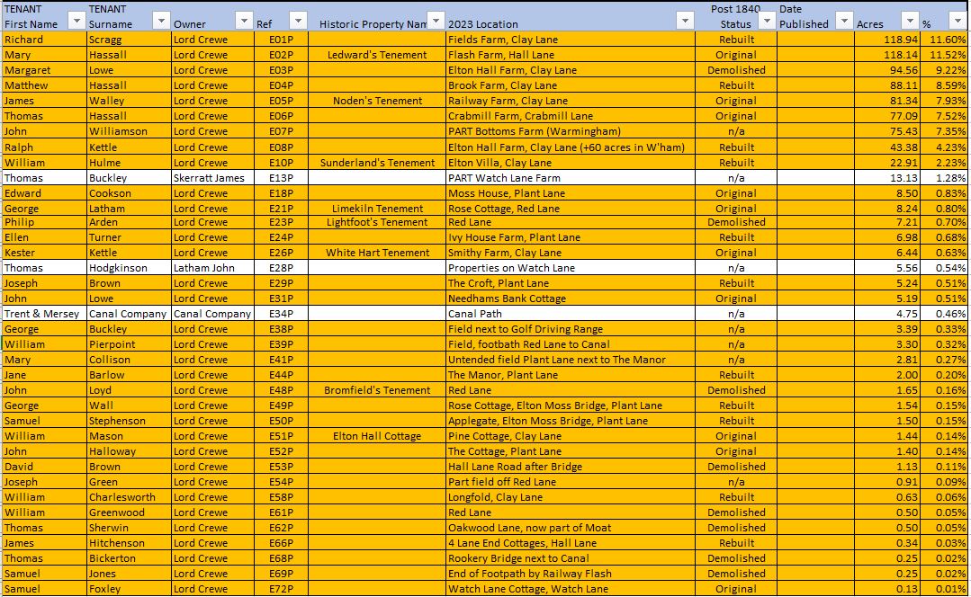
The table below summarises occupation of just over 800 acres of land which made up the majority of the township of Elton at the time of the Tithe Map. Since 1970 and local government reorganisation, this land now forms part of Moston
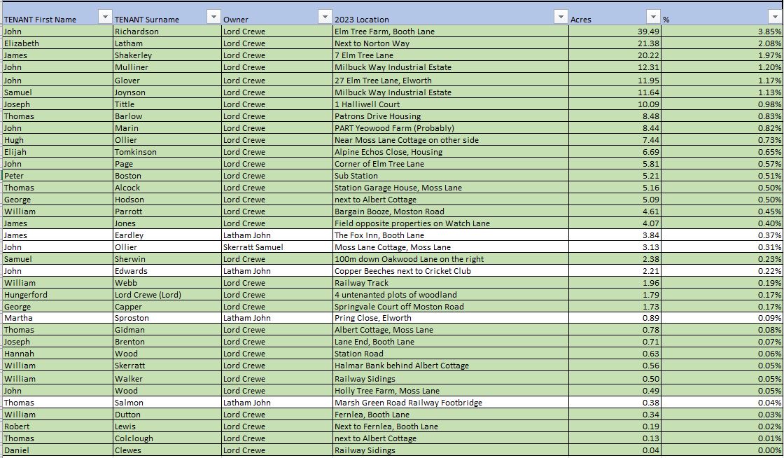
At the time, there were a further 200+ acres of land which have been transferred to Elworth, with the Trent and Mersey Canal effectively being the border.
Unlike its neighbour the township of Moston which would be eminently recognisable should our forebears return, most of the properties in Elton have been lost to the course of history with perhaps as few as ten from this time still existing.
Properties which have been lost generally fall into one of the four categories below
- Those on the course of the Crewe to Manchester Railway Line built in 1846.
- The development of Elworth in the late nineteenth century which became a significant residential suburb of the town of Sandbach, many farms and smallholdings were demolished to make way for housing estates along with Edwin Foden’s Iron Foundry
- During a similar time period, Lord Crewe had a policy of pulling down dilapidated tenements and replacing them with more modern buildings. Most of these still exist today in the distinctive Crewe estate style with the Bears Paw logo and date bricks.
- Salt mining activity in the early 20th century which played particular havoc with most of the farm houses.
In general those which are still with us have been extended to meet modern demands
The real exception to all this change is Crabmill Old Farmhouse, the only property in the township to be a listed building and perhaps being in situ for 400 years going back to the time when the Crewe family first purchased the estate.
Comments, Opinions Corrections etc to John Pemberton jpembo44@gmail.com
Occupation of Properties and Land in Elton at the time of the Tithe Map 1840
Occupation of Properties and Land in Elton but now part of Elworth